
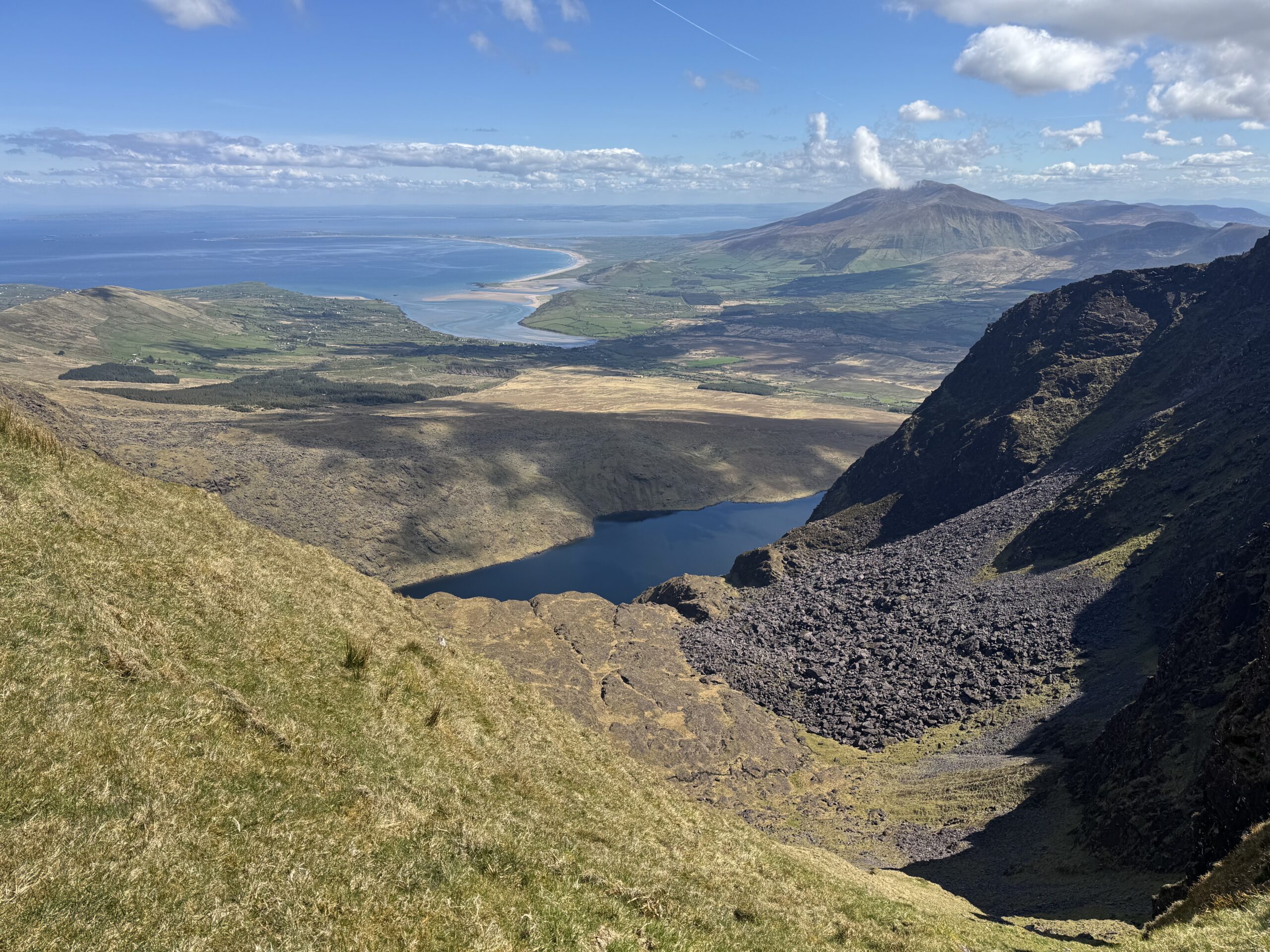
Mount Brandon is one of those trails that should sit on everyone’s hiking to-do list. If it isn’t on yours, then you definitely need to add it! I ticked it off my list recently by completing the Mount Brandon Loop.
At 952 metres, Mount Brandon is Ireland’s third highest mountain (as per Mountaineering Ireland’s Highest Mountains List), but height alone isn’t what makes it special. Its position on the Dingle Peninsula means that, on a clear day, you can get amazing views of the Wild Atlantic Way on both sides of the peninsula.
There are several ways to climb Mount Brandon. For this walk, we tackled the Mount Brandon Loop from Cloghane, approaching the mountain via the Faha Route before continuing across Brandon Peak (840m) and Gearhane (803m), and eventually descending back towards Cloghane.
It turned out to be one of the most spectacular mountain walks I’ve completed in Ireland. Check out my full list of Wild Irish Walks here!
The first part of the day takes you beneath the enormous cliffs on the eastern side of Mount Brandon, past a series of mountain lakes and up a very steep climb (known as the Éisc) to the main ridge. From Mount Brandon, the route continues across Brandon Peak and Gearhane. This section offers some of the best views of the entire walk, with the Atlantic visible on both sides of the ridge. Look left and you can see across Brandon Bay; look right and the views stretch out towards the Blasket Islands.
The final few kilometres aren’t quite as spectacular. There’s a long descent, an old farm track and eventually several kilometres of road walking back to Cloghane.
But the mountain section is exceptional.
Mount Brandon Loop Details
- Distance: 21.1 km for the full loop
- Time required: 8.5 – 9 hours
- Highest point: Mount Brandon – 952m
- Difficulty: Hard
- Start/finish: Cloghane, County Kerry
- Main summits: Mount Brandon (952m), Brandon Peak (840 m) and Gearhane (803m)
- Terrain: Road, mountain paths, rocky and steep mountain terrain, rough grass and farm tracks
Our Walk
I completed this walk with my uncle Denis. We were fortunate enough to have two vehicles available. I was staying in nearby Dingle for a week’s holiday. The plan was that my wife Paula would drop me in Cloghane and then she and our 3 year old son would go to Castlegregory for a day at the beach. We had agreed to meet Denis in the village of Cloghane on the morning of the hike.
After meeting in Cloghane though, we decided that it would be a good idea for Paula to leave us a bit further up at the Faha car park. We could then start the trail from there. As such, the actual walk we completed is a few kilometers less than what is noted in the full trail details above.
The Faha car park is the usual car park for people completing the out-and-back to Mount Brandon along the Faha Route.
Faha Route vs Faha Ridge
I have to admit I got a little nervous when I started researching this route in advance of the hike. I’d heard of the Faha Ridge before. The famously narrow and exposed ridge is known as a serious bit of scrambling. I was a little relieved when I found out that the Faha Route for Mount Brandon is actually different to the Faha Ridge.
The Faha Route is the most commonly used walking route to approach Mount Brandon from the east. It involves a spectacular corrie beneath Mount Brandon. However the trail actually passes below the much more serious Faha Ridge.
Faha Grotto
We said our goodbyes and Denis and I started the Mount Brandon Loop. Pretty much straight away we spotted a sign directing us to the Grotto. We crossed a stile and headed up towards the Shrine.
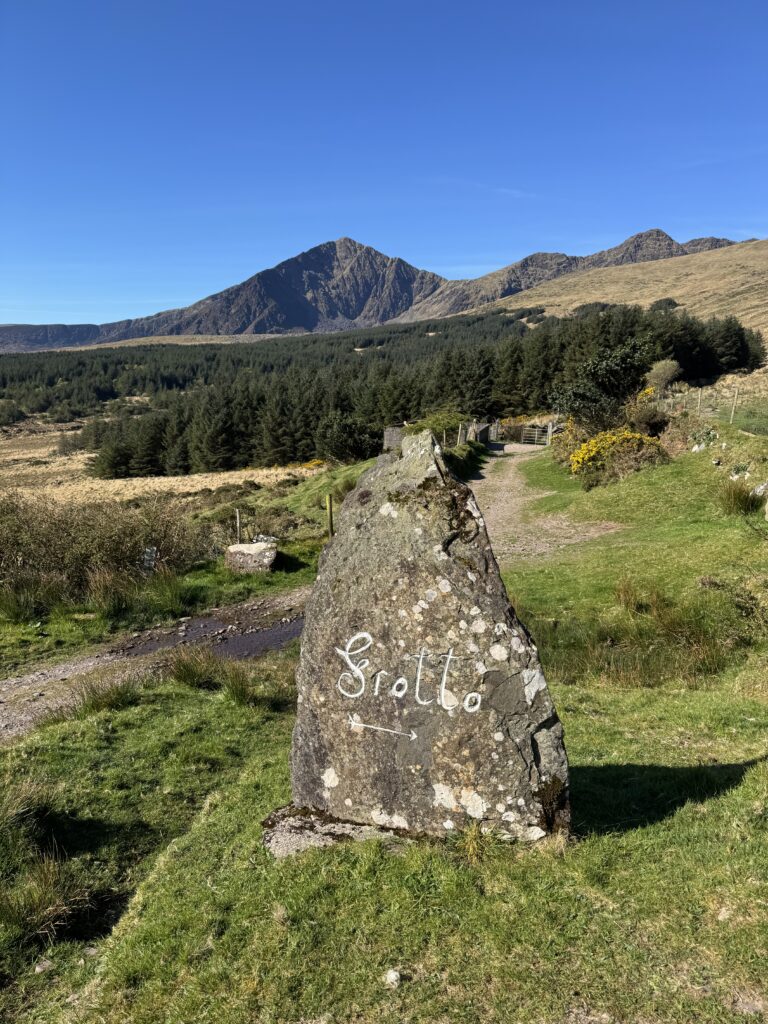
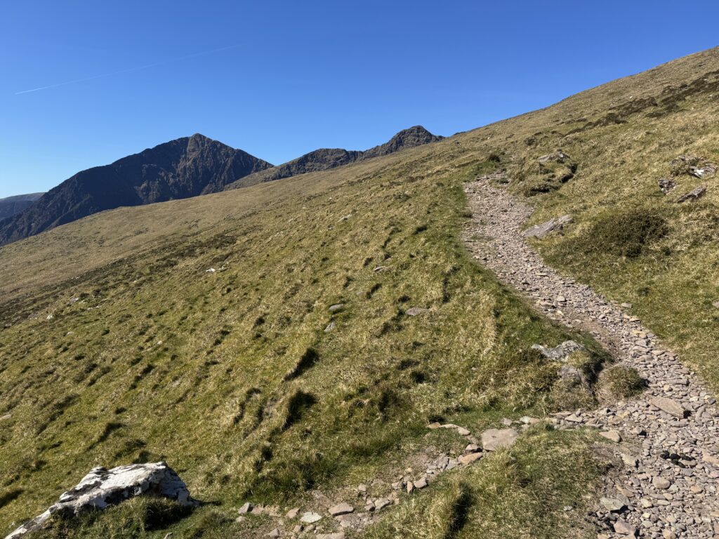
I admired the views from this little oasis of calmness at the start of the walk. This gentle introduction to the Brandon Loop continued for another while as we crossed the green foothills of the mountain.
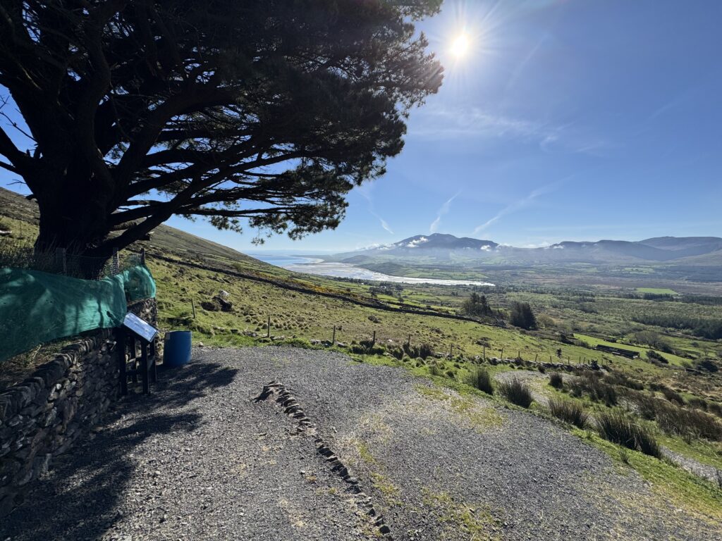
As we made our way along the well defined path, we had a strange little coincidence. A hiker coming down the mountain approached us. As she neared, she hailed Denis and they stopped for a chat. They knew each other. Normally that wouldn’t be particularly noteworthy. Except exactly the same thing had happened the previous day while we were hiking Masatiompan and Sauce Creek.
Maybe the Irish hiking community is smaller than I thought. Or maybe Denis just knows everybody!
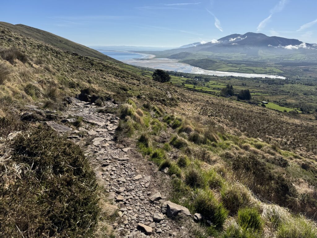
The Mount Brandon Aircraft Crash
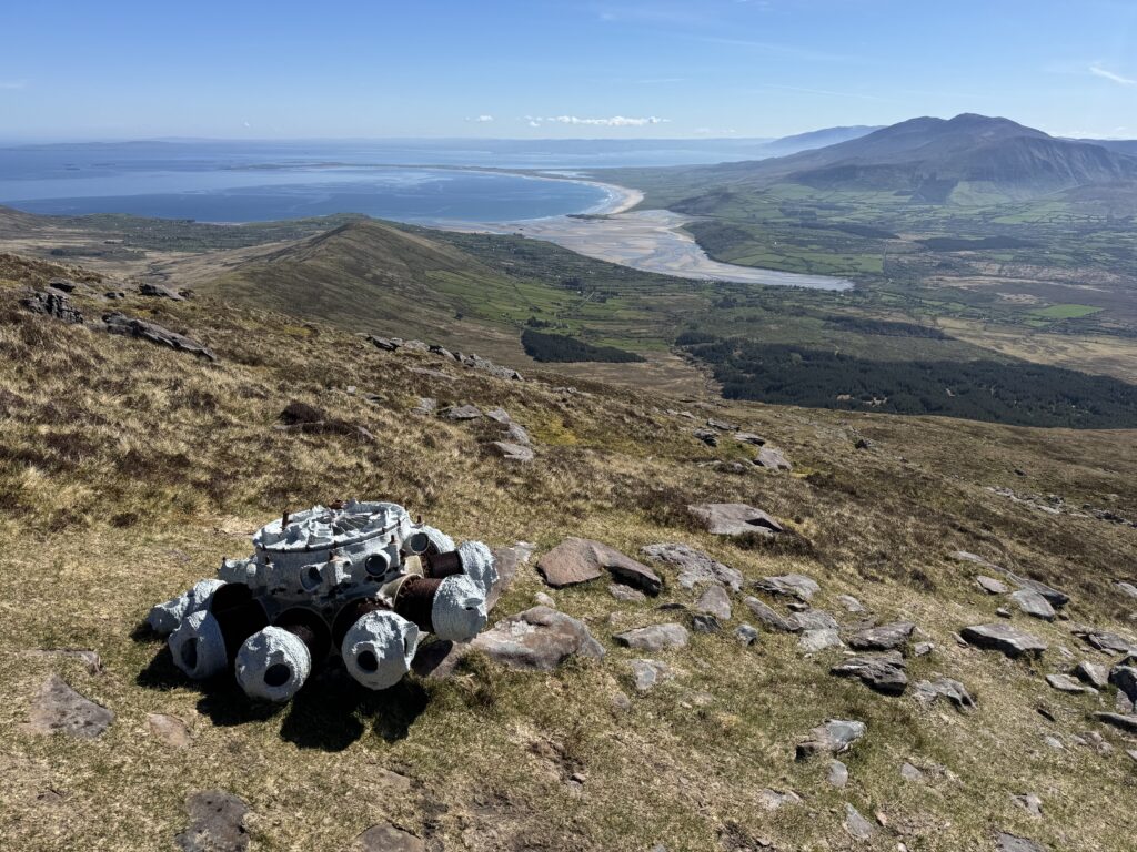
Just under an hour into the Mount Brandon Loop, we came across the crash site of a Second World War aircraft.
On 20 August 1940, a German Luftwaffe plane came down here. The six-man crew survived. They were arrested and interned in The Curragh for the remainder of the war. This site is one of several aircraft crashes around the Mount Brandon area during the Second World War. We had also come across one on our hike to Masatiompan the previous day.
It’s an unusual piece of history to encounter in the middle of a mountain walk. We stopped at a wooden bench that has been placed there by the family of one of the survivors of the crash. Strangely, the bench was lying upturned when we passed. I’m not sure why.
The view from the bench should be of the lovely Lough Nalacken to the south. If you turn right, uphill and off the path when you reach the bench, you will actually see the remains of one of the engines of the plane! I found it well worth the small detour.
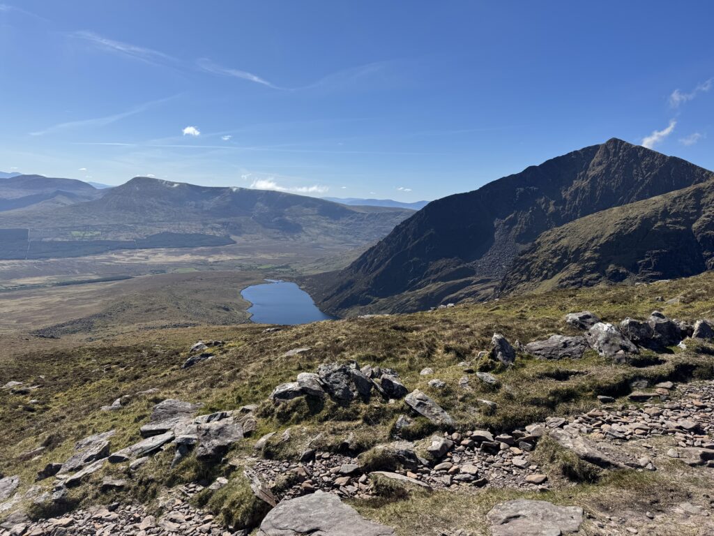
We didn’t delay too long though as there was still a long way to go from here. The scenery became increasingly impressive as we moved deeper into the mountains.
Into the Faha Valley
This was probably the point where the walk really began to stand out for me.
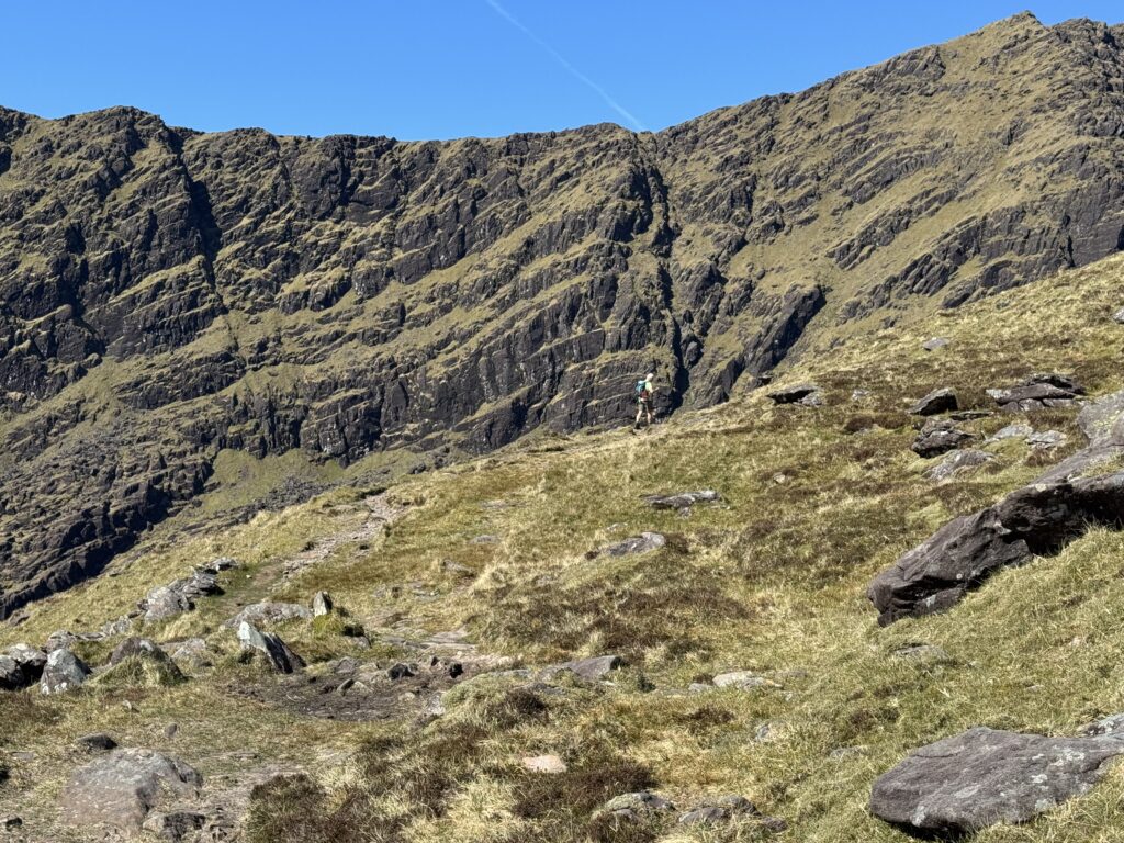
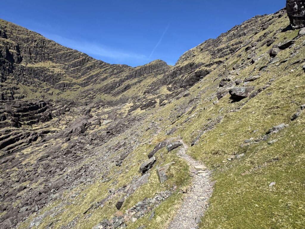
The route enters beneath the enormous eastern cliffs of the Brandon Mountains, with a succession of small ribbon lakes sitting below.The setting is superb. Before climbing directly towards the summit, we walked into what felt like an enormous natural amphitheatre.
Cliffs rose steeply above us while we walked along a path cut into the lower part of one side of the valley. The trail continued into what looked like a dead end. We reached the floor of the valley and I still wasn’t sure how exactly we were going to get up? It simply looked too steep.
The Climb towards Mount Brandon
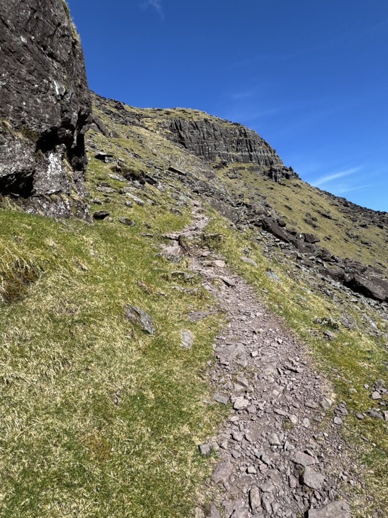
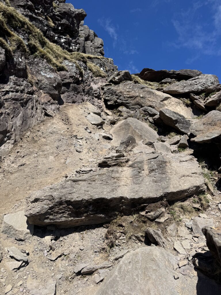
The way through the seemingly impenetrable cliffs is via the Éisc, the steep gully at the head of the corrie. The name is fitting – éisc essentially refers to a cleft, fissure or ravine in the mountainside.
From the valley floor, the trail climbs sharply through the Éisc towards the main Brandon ridge, zig-zagging upwards over steep ground. In some sections, I needed to use my hands to scramble up.
I wouldn’t describe what we encountered as technically difficult in the conditions we had. However, you do gain a lot of height over a relatively short distance.
Thankfully, stopping occasionally to look behind you is highly recommended.
As we climbed, the views back into the corrie became increasingly spectacular. The lakes were now far below us and, as we moved higher, we had stunning views towards the Faha Ridge and out to the Atlantic. In fact, the views back towards the Faha Ridge itself were amazing. The distinction between the Faha Route and Faha Ridge became very obvious from this height.
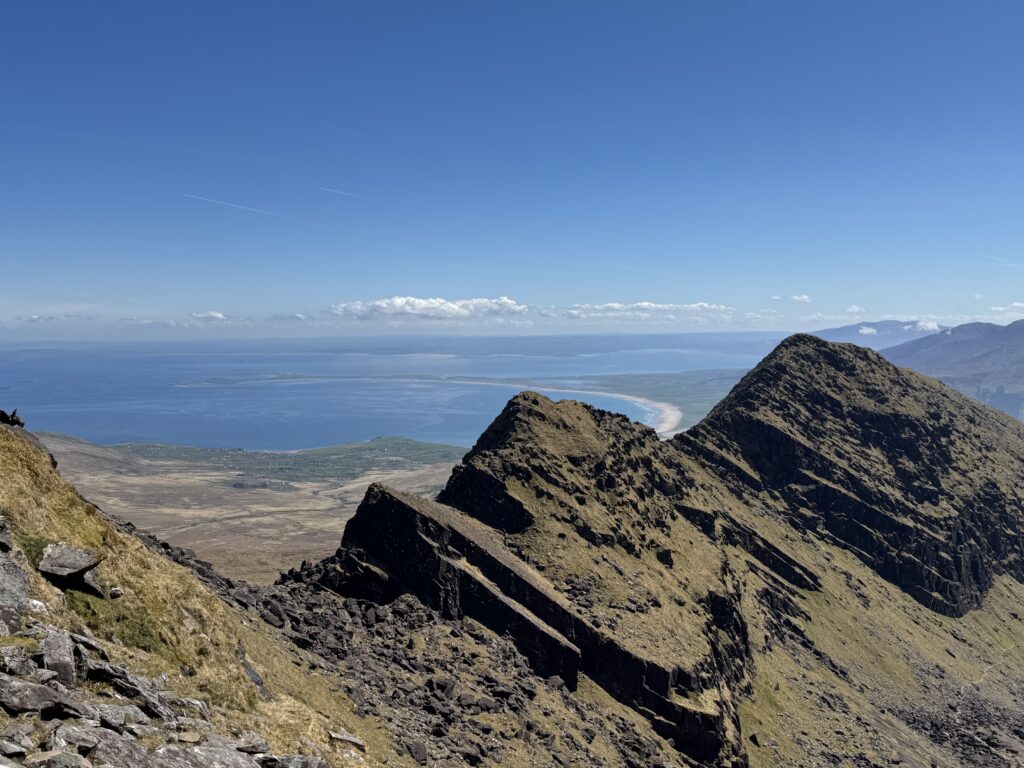
We had taken the walking route through the valley below. Above it was this dramatic rocky ridge. I’d been a little nervous of the ridge before starting the walk. Looking across at it now, however, my outlook changed completely.
I found myself thinking: I’m coming back to do that. Definitely one to look forward to.
Reaching the Main Brandon Ridge
Eventually the gradient eased as we reached the main Mount Brandon ridge. We completed Éisc and turned left along the ridge. From here, we were now fairly close to the summit of Mount Brandon.
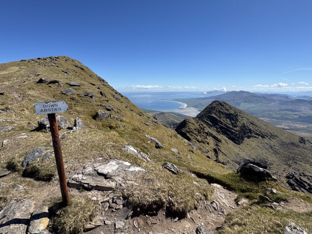
I noticed the landscape changed quite dramatically too. After spending so much of the ascent enclosed by the cliffs surrounding the Faha corrie, we found ourselves suddenly back in much more open mountain terrain.
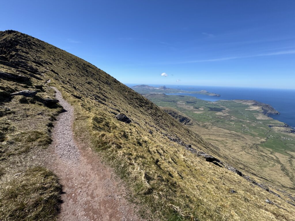
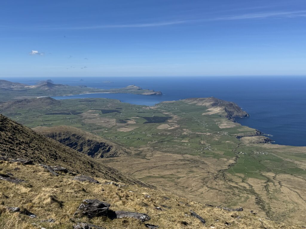
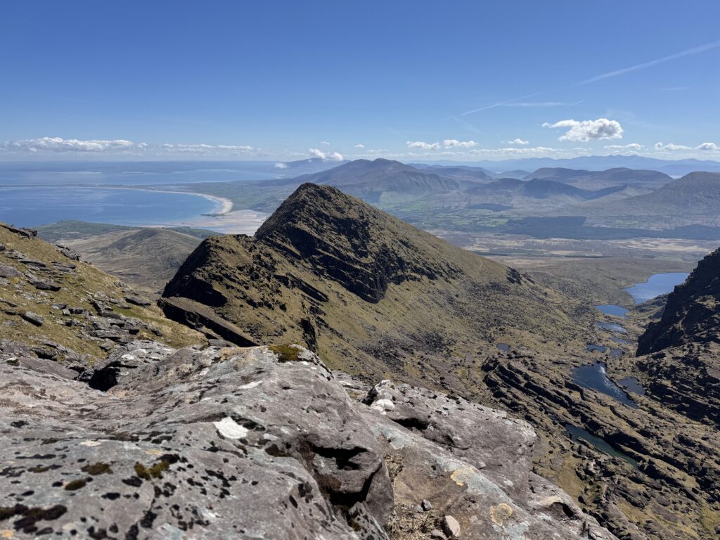
Mount Brandon Summit
At 952 metres, Mount Brandon is the highest point on the Dingle Peninsula. A large cross dominates the summit. The Christian symbol is probably fitting given the mountain is named after Saint Brendan (or Naomh Bréanainn).
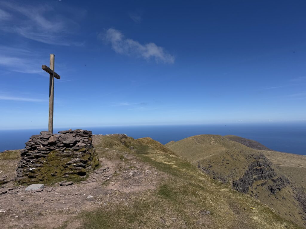
Saint Brendan the Navigator is most famed for the legend that he sailed across the Atlantic centuries before Christopher Columbus. The purpose of Brendan’s voyage was to try to discover paradise. Tradition associates Brendan with prayer and fasting on the mountain before his legendary voyage across the Atlantic. Hence the naming link.
The low stone structure in front of the cross is sometimes referred to locally as St Brendan’s Grave. However, Brendan is traditionally believed to have been buried near the monastery he founded at Clonfert in Co. Galway. The structure on Mount Brandon is more generally identified as the remains of St Brendan’s Oratory, a small place of prayer associated with the mountain’s long history of pilgrimage.
Interestingly, there have also been suggestions of a link between the mountain and the Irish mythological figure of Bran. There is an intriguing parallel aside from the similarity in names. Bran is the central character in The Voyage of Bran, an early Irish tale in which he sails west across the ocean in search of an otherworldly land.
The Views from Mount Brandon
We were extremely lucky with the weather. The views were enormous.
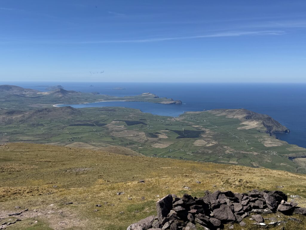
The Atlantic stretched away from the peninsula while mountains, valleys and coastline spread out below us. The top of Mount Brandon gives you a great vantage point to see the zig-zag path up through the Éisc.
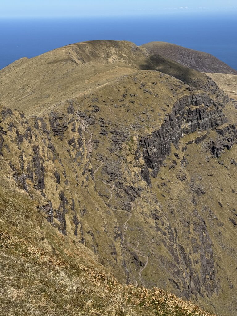
But reaching Mount Brandon wasn’t the end of our walk. Not even close. Our route next turned south towards our next objective…Brandon Peak.
Mount Brandon to Brandon Peak
Leaving Mount Brandon, we could see much of the route ahead.
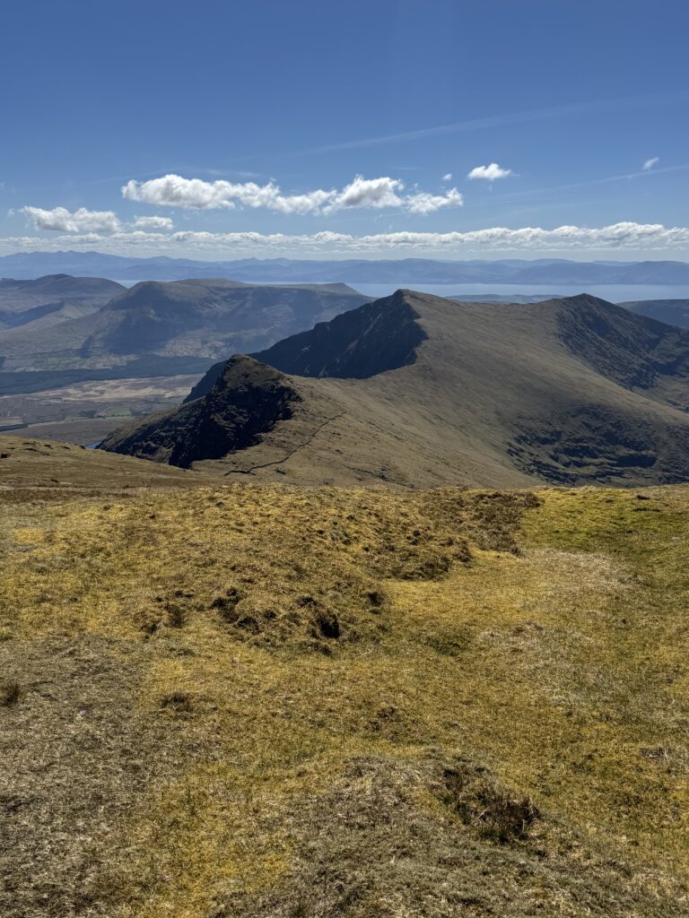
Initially, the walking was relatively straightforward as we followed the high ground south. The trail ran alongside the stone wall so proved easy to follow
This was another fantastic part of the hike because the views began opening up on both sides of the ridge. At various points we could look down towards completely different sides of the Dingle Peninsula.
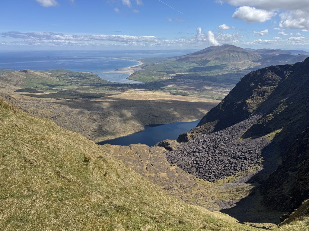
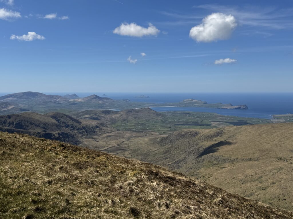
After the enclosed surroundings of the Faha corrie earlier in the day, this felt completely different. The ridge was open, airy and spectacular.
Brandon Peak loomed ahead. And just like that, we were done with the easy part of the walk.
The Steep Climb to Brandon Peak
The final climb to Brandon Peak was extremely steep.
I found this the toughest slog of the day. Even harder going than the climb up the Éisc. I think the fact that we now already had Mount Brandon in our legs made the gradient much more noticeable.
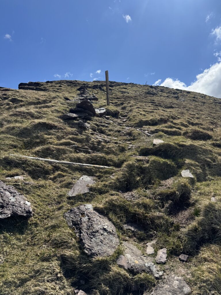
Again, though, the views more than made up for the hardship. It felt like longer but in reality, the toughest part only really took about 15 minutes. After that, we found ourselves at the top of Brandon Peak at 840 metres.
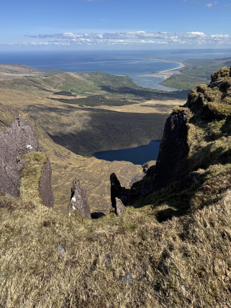
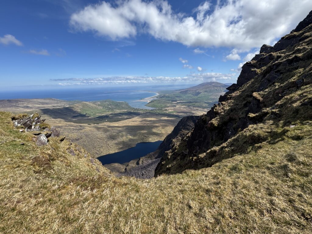
We decided this was as good a place as any to stop for lunch. There are worse places to eat a sandwich. While having our lunch, a WhatsApp came in with a picture of my wife and son eating ice-creams on the beach. After the tough climb up to Brandon Peak, I felt very envious!
Brandon Peak to Gearhane
From Brandon Peak, our next target was Gearhane at 803 metres.
Getting there meant dropping down from Brandon Peak before climbing again towards Gearhane. Looking across at it, the next climb appeared fairly intimidating. Thankfully, it looked considerably worse than it actually was.
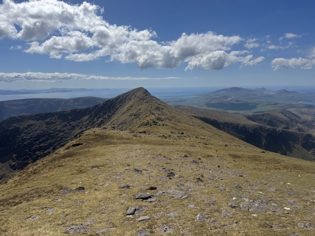
After the slog up Brandon Peak, the climb to Gearhane proved relatively straightforward. This section also proved to be the end of the really spectacular higher altitude section of our day. Unfortunately, this also meant the end of the best of the views. I tried to drink them all in.
Descending from Gearhane
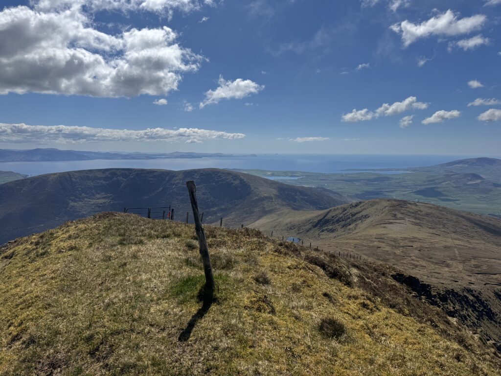
From the final high point, we began the long descent.
We crossed a fence and made our way over rough grass. We were aiming for a small lake and a farm track that ran beside it. As we walked, we gradually lost height on the approach to the track.
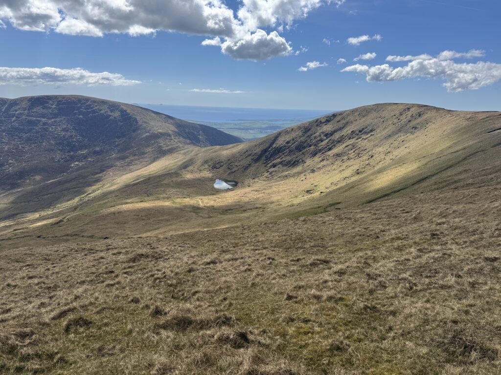
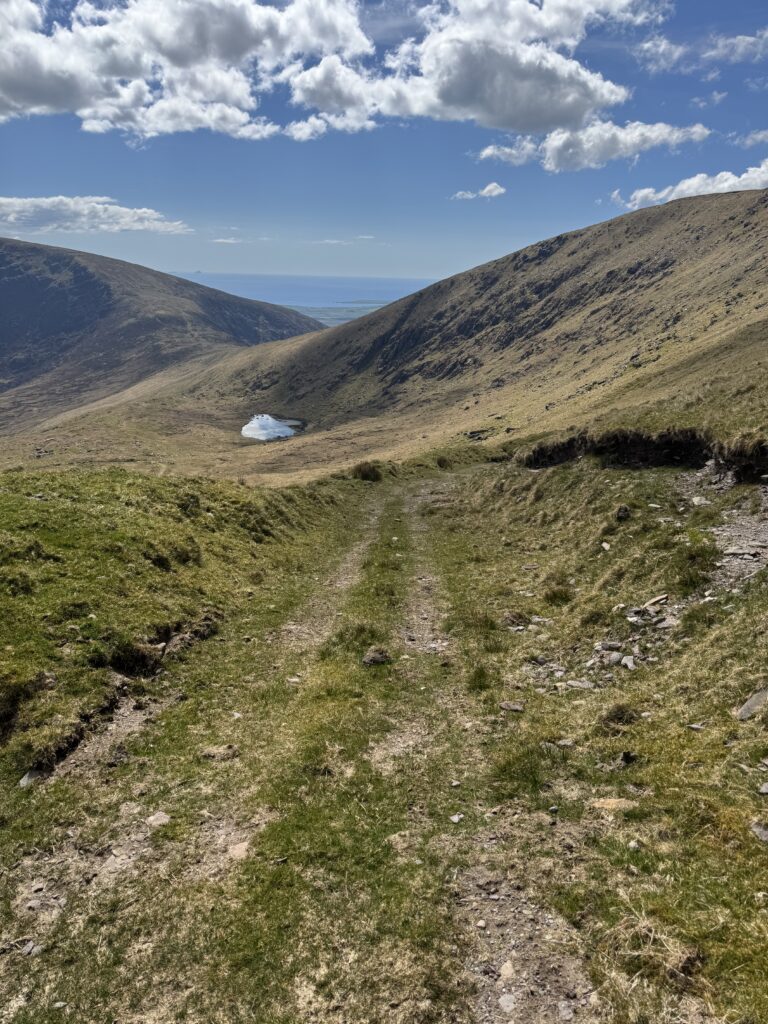
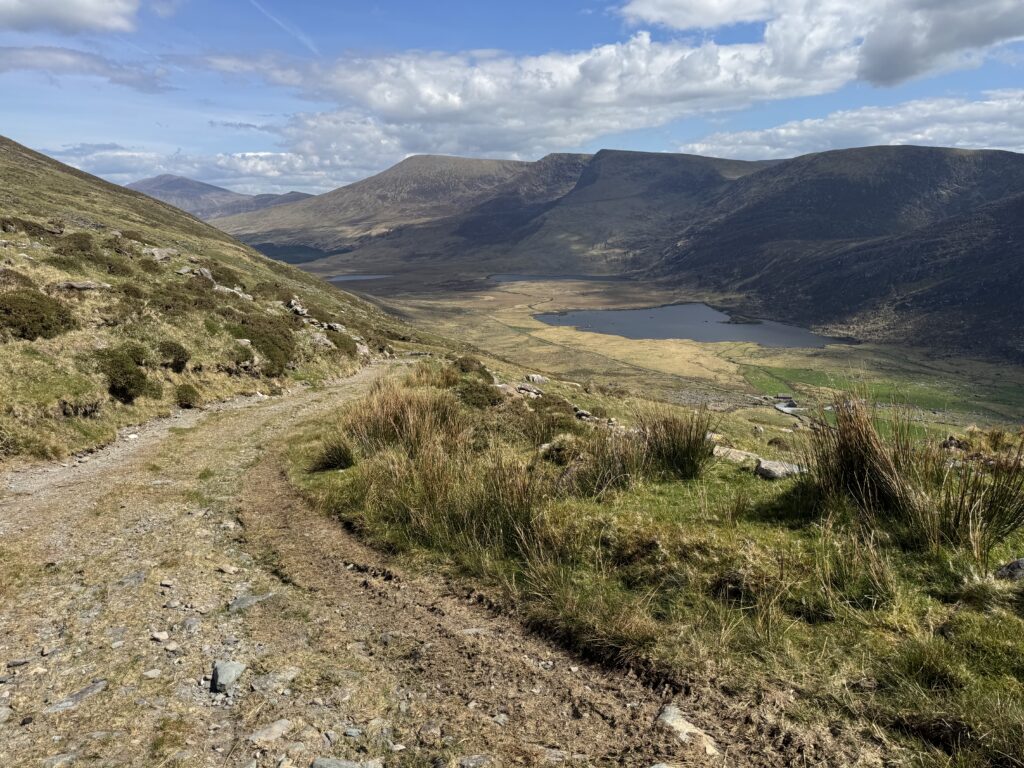
The vibes of the trail had changed too. After hours of cliffs, lakes, summits and ridge walking, this was now about getting back down.
And it took a while.
The Long Farm Track
The old farm track provided an obvious way down, but I didn’t particularly enjoy it. There were plenty of loose, uneven stones underfoot and, after several hours of walking, they became increasingly uncomfortable on tired legs.
It was also a long descent. Eventually the track brought us towards a farmyard. This was probably the oddest part of the route.
Through the Farm
On our visit, the gates we encountered around the farm were locked. Some also had tight sheep wire running through the rungs, which made getting past them awkward.
I don’t want to read anything more into that than what we actually encountered on the day. Access arrangements can change, and anyone following the route should respect private property, livestock, signage and whatever arrangements are in place when they visit. I’ve crossed countless farms and gates on walks around Ireland, but this particular section just didn’t feel especially walker-friendly.
Once we’d made our way through, we eventually reached the road. At which point there was some good news and some bad news.
We were fully finished with all the difficult terrain sections of the hike. Unfortunately, though we were left with a long stretch of road walking – which I personally don’t really enjoy.
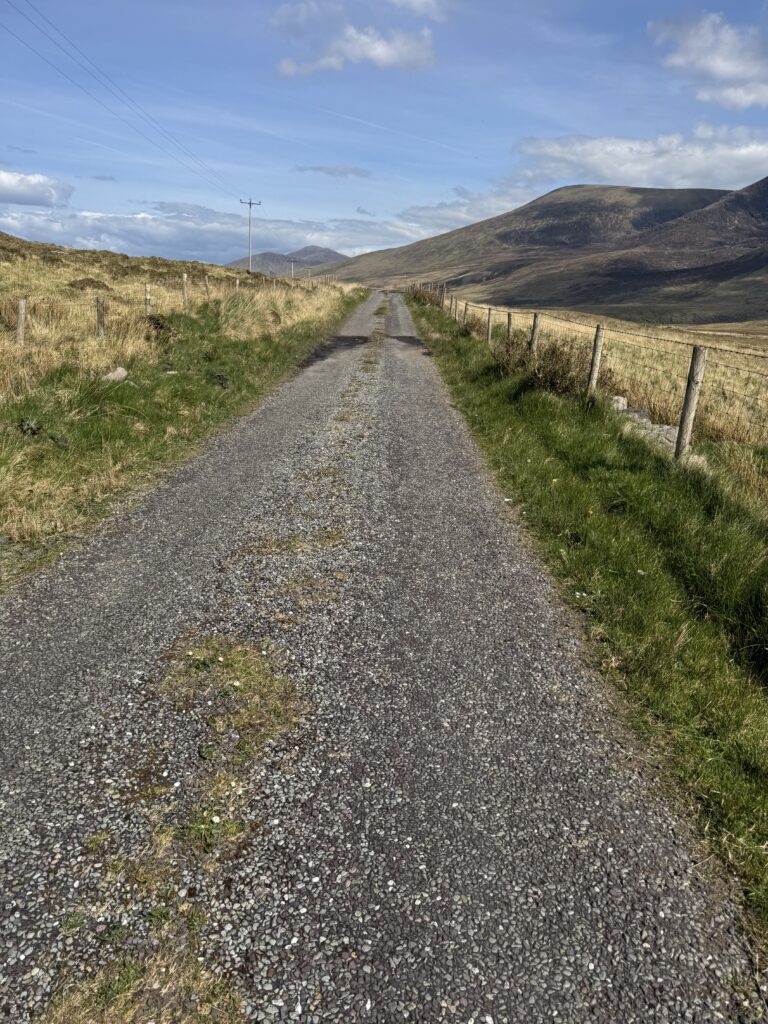
The Road Walk Back to Cloghane
We still had around 6 kilometres of road walking before reaching Cloghane.
I don’t want to make this section sound worse than it was. These were actually some lovely stretches of quiet country road. Streams ran alongside the road in places, with green fields, sheep and occasional lakes around us. Looking backwards also provided some fantastic views of the mountains we’d just crossed towering above the valley.
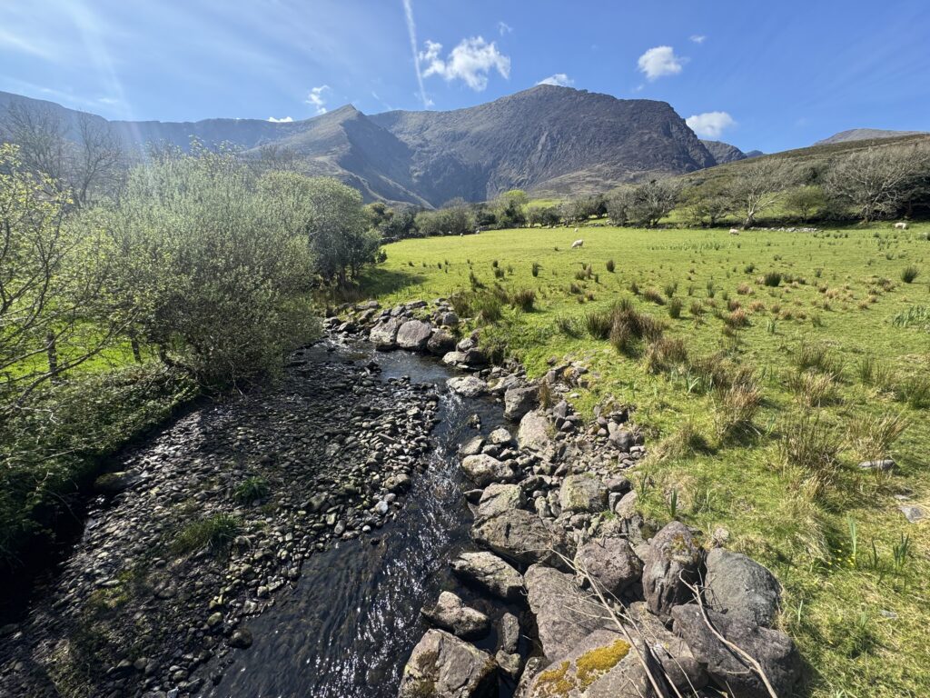
But there was no escaping the length of it. After spending hours walking beneath cliffs, past mountain lakes and across the Brandon ridge, several kilometres of tarmac was inevitably going to struggle in comparison.
Eventually, however, Cloghane came back into view. We were both delighted to be back. There was only one sensible way to celebrate.
Ice cream!! Siopa an Phobail across from the church sorted us out.
How Difficult Is the Mount Brandon Loop?
I’d rate the Mount Brandon Loop as a hard mountain walk.
The full route is more than 20 km, involves well over 1,000 metres of climbing and contains two particularly steep ascents – firstly out of the Faha corrie via the Éisc and later onto Brandon Peak.
There’s also a substantial amount of time spent in exposed mountain terrain. We got lucky with the weather. Otherwise, this would have felt like a very different experience.
In addition, navigation becomes considerably more difficult in poorer weather conditions.
Good boots are also essential for this one. Between the rocky mountain terrain, rough descent and loose stones on the farm track, this isn’t somewhere I’d want inadequate footwear.
And finally, don’t underestimate the road walk.
Six kilometres on tarmac doesn’t sound particularly difficult when you’re sitting at home looking at a map.
It feels a bit different after you’ve already climbed Mount Brandon, Brandon Peak and Gearhane.
Is the Mount Brandon Loop Worth Doing?
Yes – the Brandon Loop is definitely worth doing. Combining Brandon Peak with Mount Brandon isn’t what most people do; however it really adds to the walk.
The whole mountain section is outstanding. The Faha Route into the corrie, the chain of lakes beneath the cliffs, the steep climb onto the main ridge, Mount Brandon itself and the continuation across Brandon Peak and Gearhane combine to make this one of the most spectacular stretches of mountain walking I’ve experienced in Ireland.
The final section just isn’t at the same level. The descent is long, the farm track becomes tiring and the extended road walk into Cloghane feels like an anticlimax after everything that has come before.
If I was doing it again, I’d try to have a car available where we start the road section. Overall though, I really enjoyed the Mount Brandon Loop. I’m delighted to have marked this one off my list!